 |
 |
|
|
Sources
(Corrected links to follow)
Google Earth - for Android
GPS Logger - for Android
Geo Tracker - for Android
Easy GPS Logger - for Android
Bike Hike - http://www.bikehike.co.uk
Ordnance Survey - https://www.ordnancesurvey.co.uk/
Introduction
This review is being updated as a number of other products have come on the market and Outdoor Active has changed a great deal since this was originally written.
As readers of this site will know, the planning and logging of journeys and capturing of related statistics has been an interest of ours for some time. The earliest of the sophisticated systems we used was the satellite enabled cycle computer reviewed a long while ago. Sadly that is no longer functional, not because the unit has failed, but because the software, operating system and format used for data have now all been superseded. In parallel with that decline there has been a fall in the price of, and growth in the use of, smart phones. These ‘pocket computers’ now do so much more than making phone calls that it seems logical that they should be used for route logging and similar duties.
The availability of Google’s MyTracks as a free logging tool and Google Earth as a viewing and planning tool must have introduced the hobby to a great number of people. Sadly, MyTracks has now been withdrawn and the question is where does one go to get the same facilities without shelling out a lot of cash. Additionally the process of publishing and sharing one’s routes has become popular so this is an area that needs to be added into the discussion.
Track Logging
This is the area in which Google’s MyTracks was so useful to the smart phone owner since it was so easy to use and could also seamlessly link to Google Earth for displaying the track afterwards. Three small programs are now available that focus on just logging your position and then allowing the track to be saved in one of several common file formats. They all offer additional data on such things as distance travelled, average speed and possibly altitude gain and loss. None of them allow the user to see the track on a map after it is completed and require a mapping application for that function. Note that the nomenclature used by this sort of application is ‘track’ for data showing where you have been and ‘route’ for a plan of where you want to go in the future.
The three are GPS Logger, Geo Tracker and Easy GPS Logger and all are available free of charge. I have used GPS Logger and found, as the saying goes, ‘it does exactly what is says on the tin’. However, a desire for easy integration of track and map led to a search for a program that can do more. I already had an old edition of Memory Map which allows logging, display and route planning. The down side was the lack of an update facility for the maps and the large initial outlay for the software. I understand that the cost is now much reduced, but I was seeking a low cost alternative solution. Much internet surfing suggested that Outdoor Active might be a possible alternative that could be used satisfactorily without cost or at low cost. It is available for Android and iOS as an app plus Windows in web only format. As for most of the ‘free’ applications on the these platforms the user must register and create a password before being able to use the program.
At this point it should be pointed out that Outdoor Active and the app has become a great deal more sophisticated as well as giving the user lots of opportunities to spend money. Fortunately the basic app remains free.
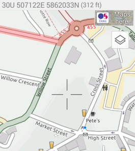
Outdoor Active users are not bombarded with adverts except for the occasional suggestion of a map purchase or an upgrade to ‘Premium’. This is probably because the site makes its money by selling maps to users. However, Open Street Map and Open Cycle Map are provided for use without charge. The latter is probably the best map to use for walking, handcycling and cycling. Thus the user can download and save a series of map tiles to cover the area in which they intend to walk or cycle. The program will then use the saved tiles which means that internet connectivity is not required when the user is logging a track. The screen will display the map with the current location as a cross and a line recording where the user has been. I have found this feature very useful when visiting strange towns since it is possible when ‘lost’ to use the line and the rest of the map to find right destination or the way out. Any tracks that are logged can be saved.
Saved tracks are recorded in the Tracks sub directory of the app. However, all recorded tracks can be exported as GPX format files from within the app if they are first converted to ‘Routes’.
Having recently purchased an OS map that includes the option of downloading the digital version we have also had some interaction with the OS Maps app. This can be downloaded for iOS or Android free of charge and includes the facility to log and save tracks. The interface is nice and clean and there are no adverts to get in the way. The app will do quite a lot of things but to access them all one has to subscribe to the Premium service.
Route Planning
Under this heading there are a number of contenders worth a look. Three we have tried are BikeHike, and Google Earth. BikeHike is a website [http://www.bikehike.co.uk] while the other two can be downloaded as locally operated applications. In all three apps the mapping displayed, or satellite imagery in the case of Google Earth, is held on servers so that the user has to be online to use them. Outdoor Active is different in that it is possible to download mapping for use offline. However that is only possible with the mobile version.
Whilst all three can be used for route planning, if loaded on a smart phone, the size of screen makes this task very difficult. It seems much the easiest to use them on a big screen device such as a PC or laptop. Ironically, Google Earth and Outdoor Active are not the same in their mobile device form and PC app forms. Google Earth seems to have rather fewer functions in its mobile incarnation, while Outdoor Active is the opposite. It took a while to realise that this was the case leading to much frustration when trying to do something that was possible according to the Outdoor Active User Guide, but would not work in practice.
Once loaded on a PC, all three applications allow the user to click on a starting point and then, with subsequent clicks, lay down the route on the map. All three allow the way points thus created to be moved by dragging or deleted so that mistakes can easily be corrected. However, before being able to begin laying down a route the user needs to locate themselves on the map.
BikeHike uses Ordnance Survey maps and now the Open street Map series, and has access to the familiar OS 1:50k scale, but also provides a 1:25k OS map that looks as if it was developed for sale to Sat Nav vendors. It looks quite similar to Open Street Map and Google Maps in high magnification. Buildings and roads are shown but paths and all other details are missing. This is unfortunate if the plan is to develop a route for walking/handcycling that uses footpaths. In that case one would need to stick at the 1:50K scale. The system also has access to the OS road atlas scale 1:250k scale as well as the OS route planning map which is an even larger scale. These make finding a location very easy despite the limitations of the working screen window. Having found the right area all that is required is to zoom in to the appropriate level of detail.